Browse Items (21 total)

U.S. Coast Survey, Florida Peninsula

FCW0018.tif
A map from a U.S. coast survey depicting Cape Florida (Fla.) to Tortugas Islands from 1845 to 1862.

Rebel Privateer Chasing Schooner Laura Ann

FCW0019.jpg
The rebel privateer Florida chasing the schooner Laura Ann, about 400 miles west of Bermuda and sketched by Capt. Warn.

Rebel battery in Pensacola, Florida during Civil War

FCW0002.tiff
Soldiers in the Confederate States of America Army in Pensacola, FL during Civil War

Portrait of Union Private Robert J. Jones

FCW0003.tif
Portrait of Union Private Robert J. Jones, who died at the Battle of Olustee, Florida.

Portrait of Captain Edwin Camden - Volusia County, Fla.

FCW0006.tif
Captain Edwin Camden rode with Stonewall and was one of the "Immortal 600." He put on his Civil War veteran's uniform and tried to register for the draft on the first day of World War I.

Pensacola Bay

FCW0016.tif
A hand-colored map depicting Pensacola Bay in 1861.

Notice to Gov. John Milton from Jefferson Davis

FCW0014.jpg
This letter was written by Jefferson Davis to Gov. John Milton to notify Milton that Robert E. Lee has been assigned to command the confederate forces in South Carolina, Georgia and Florida.

Newspaper Article from the Florida Sentinel
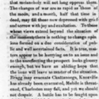
FCW0008.tif
Newspaper clipping from The Florida Sentinel forecasting that the recapture of Charleston will happen before mid-November, 1863.

Newspaper account of the Battle of Olustee

FCW0015.tif
This article offers a Union perspective on the Battle of Olustee, Florida. It was featured in the Peninsula Newspaper on March 3, 1864 and copied from the New South Newspaper,

McNally's Map of Georgia, Florida, and Alabama

FCW0010_1.jpg
This is a hand-colored map of Florida, Georgia, and Alabama. The map was created by J. Wells and George B. Sherman.